
A good river is nature’s life work in song.—Mark Helprin
Along the Northern Oregon Coast, we spent a week in the bustling summer town of Rockaway. Some of the best fishing happens here, and after devoting a day to offshore fishing, we weren’t disappointed. The ice chest was full of savory rockfish and ocean-caught, dungeness crab. But it wasn’t all fishing. We beach combed most days, hiked trails, and explored waysides and state parks. Evenings, we sipped iced coffees and indulged with big scoops of Tillamook wild huckleberry ice cream on fresh waffle cones.
For me, this was a working field trip. I would be gathering plant data and photos for a three-in-one, revised edition of my wild herbs guidebook series. To find the plants needed, required taking backroads along coastal rivers and streams. So, with wheels set in motion under an azure sky, and a brisk sea breeze, we headed south to Tillamook.
There are five rivers in Tillamook County that pass through Tillamook Estuary and empty into Tillamook Bay. From north to south is the Miami, Kilchis, Wilson, Trask, and Tillamook River. These rivers with their multitude of tributary creeks and streams, offer some of the best fishing in Oregon.
Miami River: A shallow stream 13 miles long, it is the smallest watershed in Tillamook County. The Miami flows through Garibaldi and empties into Miami Cove in Tillamook Bay. In Chinook Jargon, it was called Mi-me Chuck, meaning “downriver stream.” The word “Mi-me” eventually corrupted, is now pronounced Miami. Though a small river, it yields lush habitat for juvenile salmon, is a magnet for bird migration, and a hotspot for birdwatching.
Plant data collected, 0

Kilchis River: The kilchis River is 14 miles long, and named for Chief Kilchis (1806-1866) the last free Native American of the Tillamook Peoples that lived near Tillamook Bay. Farmland quickly gave way to lush forest. The narrow winding road with its hairpin curves, teased us with a glimpse of blue and green. Turning onto a Forest Road, we crossed Kilchis Logging Bridge and gasped at our first look of this vibrant river.
Across the bridge, and a bumpy short distance later, was Mapes Creek Boat Launch, a concrete launch fully exposed to the sun; typical in summer when the river is low. The expanse of dried riverbank with slabs of cracked dirt, sand, and rock, I regretted having worn sandals. A popular swimming hole in summer, surprisingly, except for a young couple with a small child, we had the river to ourselves. During fishing season, anglers crowd these banks and float the river for Chinook salmon, chum salmon, native sea-run cutthroat trout, and the occasional stray steelhead. On a day as clear as this, the rivers translucent waters reflected the brightest blues and greens I have ever seen, but offered no wildflowers.
Plant data collected, 0.

Wilson River: Known as the “Gateway to Tillamook Forest,” the Wilson River is named for Henry Wilson, the first to bring dairy cows to Tillamook County between 1850 and 1860. The Wilson is 33 miles long, a top-notch fishing river for Chinook salmon and steelhead.
Although there were no wildflowers, I was granted a singing bush. A large swath of brambles, where from within, a sparrow sang.
Plant data collected, 1: Non-native Himalayan blackberry (Rubus armeniacus).
Trask River: Named for Elbridge Trask (1815-1863) who secured the first land claim (640 acres) and that lived along the banks of Tillamook Bay in 1848. The Trask is 18 miles long. Its forked headwaters merge and flow through a forest canyon. Its cold, clean waters support spring-fall Chinook salmon, hatchery coho (silver) salmon, winter-summer steelhead, and native sea-run cutthroat trout.


In the heart of dairy farm country, the landing, hidden between fields of tall grass, we flew right past. Turning back on Bullshit Lane, aptly named for ripening cow pies, we almost missed it again. The one-lane road between fields made us feel like trespassers. Free-range chickens roamed about snapping up grasshoppers. The parking lot was empty. The river reflected shades of moss green. The air smelled sweet of cottonwoods. The riverbank caked with dried mud. It was peaceful here, but completely void of wildflowers.
The road led upriver into the mountains with hairpin curves and with lush forest on both sides. We took the first side road following it to the end. Here, we found the first wooden drift boat chute heavily overgrown with grasses, buttercups, and Queen Anne’s lace. Calm shallow pools filled the gaps between the boulders where water striders skated and conducted their mating dances. Beyond, the river moved swiftly past. A game trail led from the woods through the grasses to rivers edge.


Farther upriver, on another side road, we dead-ended at a lavishly green site. A small rapid, full of splash and vigor, met a deep emerald pool backdropped with mossy boulders. On the bank was another drift boat chute, this one, more vertical than the last, and in much better condition. Hand-chiseled stone slabs led to the river bottom. Downstream, a massive rock shelf, submerged calf-deep, jutted from the riverbank. Not another soul around, it was wonderfully peaceful. I regretted not bringing my fly rod. I don’t think I’ve seen so many shades of green in one place. A soft breeze, almost sweater worthy, cooled the canyon. Alder leaves whispered. Wildflowers bloomed in dappled sunlight, not many, but enough to fill the void.
Plant data collected, 3: Native wild cucumber (Marah oregana), non-native creeping buttercup (Ranunculus repens), non-native Queen Anne’s lace (Daucus carota).
Tillamook River: Tillamook River flows 17 miles from the coastal mountains and through farmland and urban sprawl. During its final mile, it shares a channel with the Trask River and enters the estuary, then empties into Tillamook Bay. Its clean waters and rich habitat support sea-run cutthroat trout, spring-fall Chinook salmon and coho (silver) salmon, sturgeon, greenling, lingcod, rockfish, and surf perch. Tillamook in Salish language means People of “Nekelim” (Nehalem) or Land of Many Waters. The county is named for the Killamuk peoples who dwelled here in the early 19th century. Explorers Lewis and Clark noted four villages along south “T-Elim-ook” in what is Tillamook Bay.
Plant data collected, 0.


Featured Plant: Coast Manroot (Marah oregana)

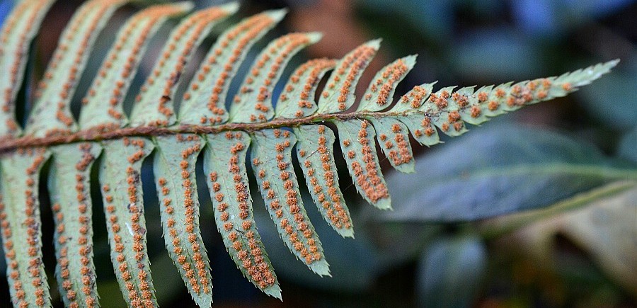
Coast manroot, also called western wild cucumber and Oregon bigroot belongs to the gourd family. A native perennial, this trailing or climbing vine can grow twenty feet long and live more than 100 years. The root is its most outstanding feature with enormous tubers that take human form and weigh hundreds of pounds. Vines are armed with soft, flexible, spines. Long tendrils branch from the leaf axils allowing the plant to climb. Leaves are large and maplelike, have five to seven pointed lobes and measure six to eight inches wide. Flowers bloom in spring, they are white to cream-colored and have five, recurved petals that surround a bright yellow center; to my eyes, they were as beautiful as porcelain. Fruit is oval, beaked pod with flexible spines; bright green with dark lines it measures one and a half to two inches in diameter, and one to three inches long. Seeds, two to four or more, are dark olive-green, smooth, compressed disks five-eighths inch to seven-eighths inch long; they disperse when the pod ripens, swells, and bursts.
Warning! Whole plant is poisonous. Fruit and seeds can cause death. Native Americans used coast manroot for medicine to treat various skin sores, scrofula sores, venereal disease, sore eyes, kidney complaints, rheumatism, swellings, boils, laxative, and as a soak for sore hands and feet. The seeds were used to oil hair, stun fish, and to commit suicide.
Habitat: British Columbia to Northern California, from the coast to mountainous areas to dry-moist sites, mixed-conifer forest openings, pine forests, oak woodlands, chaparral, thickets, stream banks, riverbanks, meadows, fields, dunes, roadsides, and disturbed sites.
Nature Chronicles© 2023 — All rights reserved.

You must be logged in to post a comment.